3D scanning is proving to be an invaluable tool in multiple industries including construction, engineering, and historic preservation.
We’ve put together this definitive guide to help you better understand what is happening with your next 3D scanning project.
# | A | B | C | D | E | F | G | H | I | J | K | L | M | N | O | P | Q | R | S | T | U | V | W | X | Y | Z |
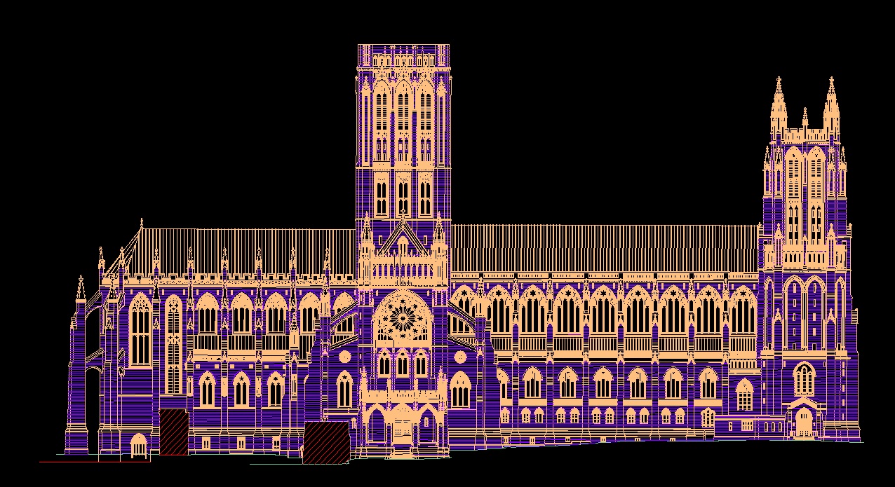
2D Drawing
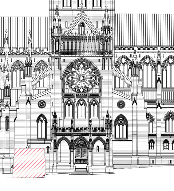
Two-Dimensional, or 2D drawings describe flat renderings that only includes two dimensions (either width and height width and length, or height and length).
Also see “Schematic”
3D Modeling
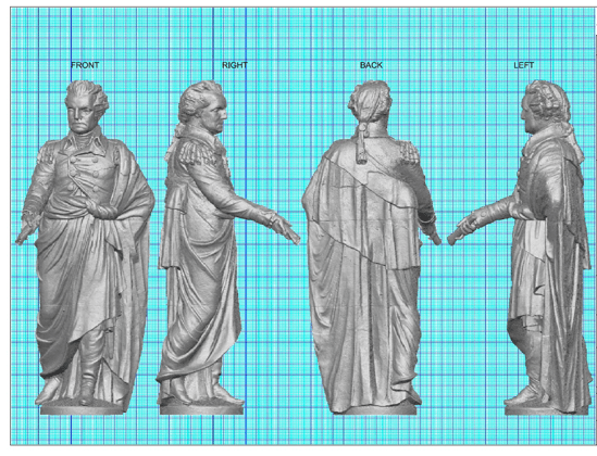
The process of creating a 3D representation of and object by manipulating polygons along the X, Y, and Z-axes.
3D Scanning
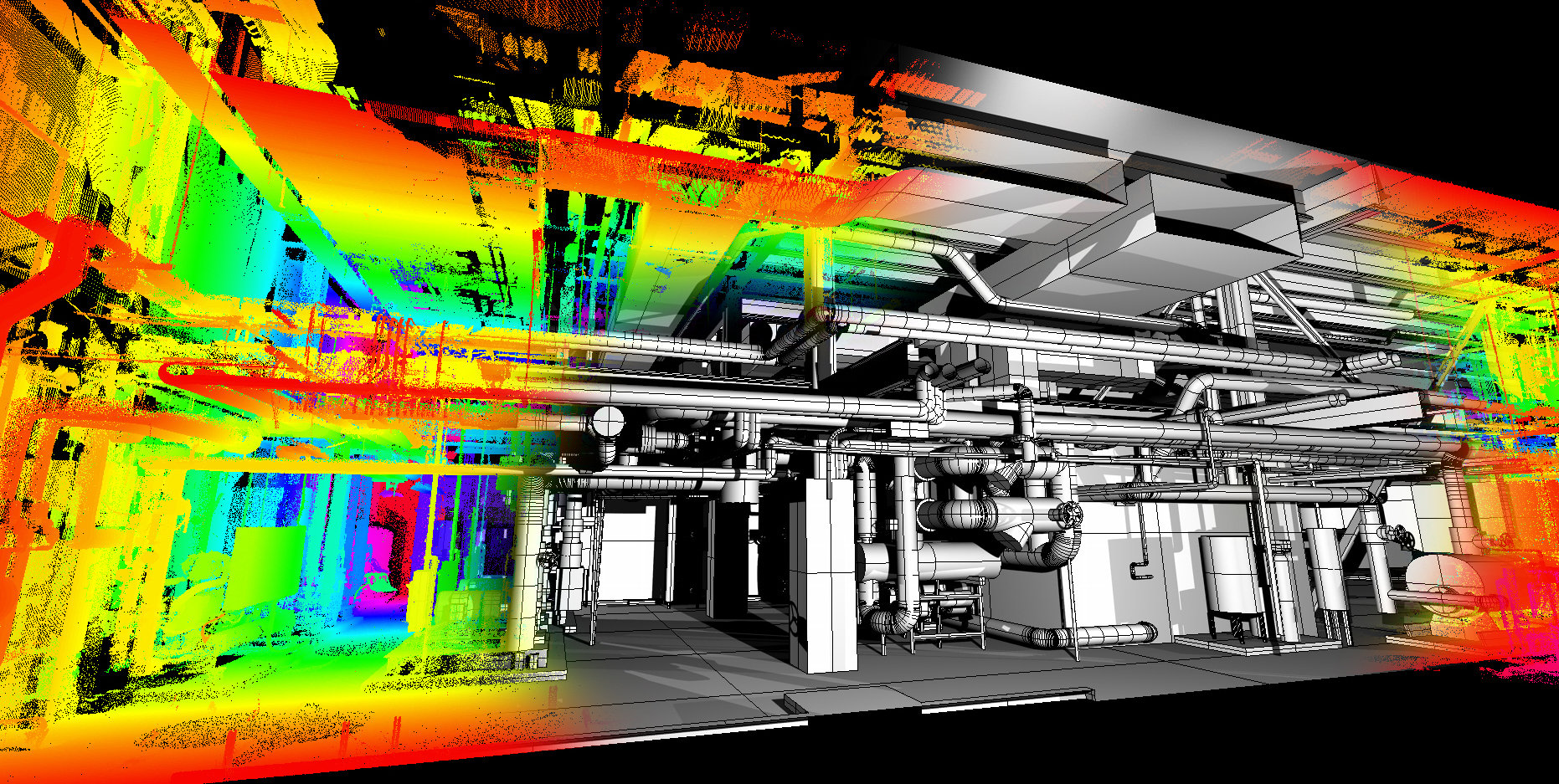
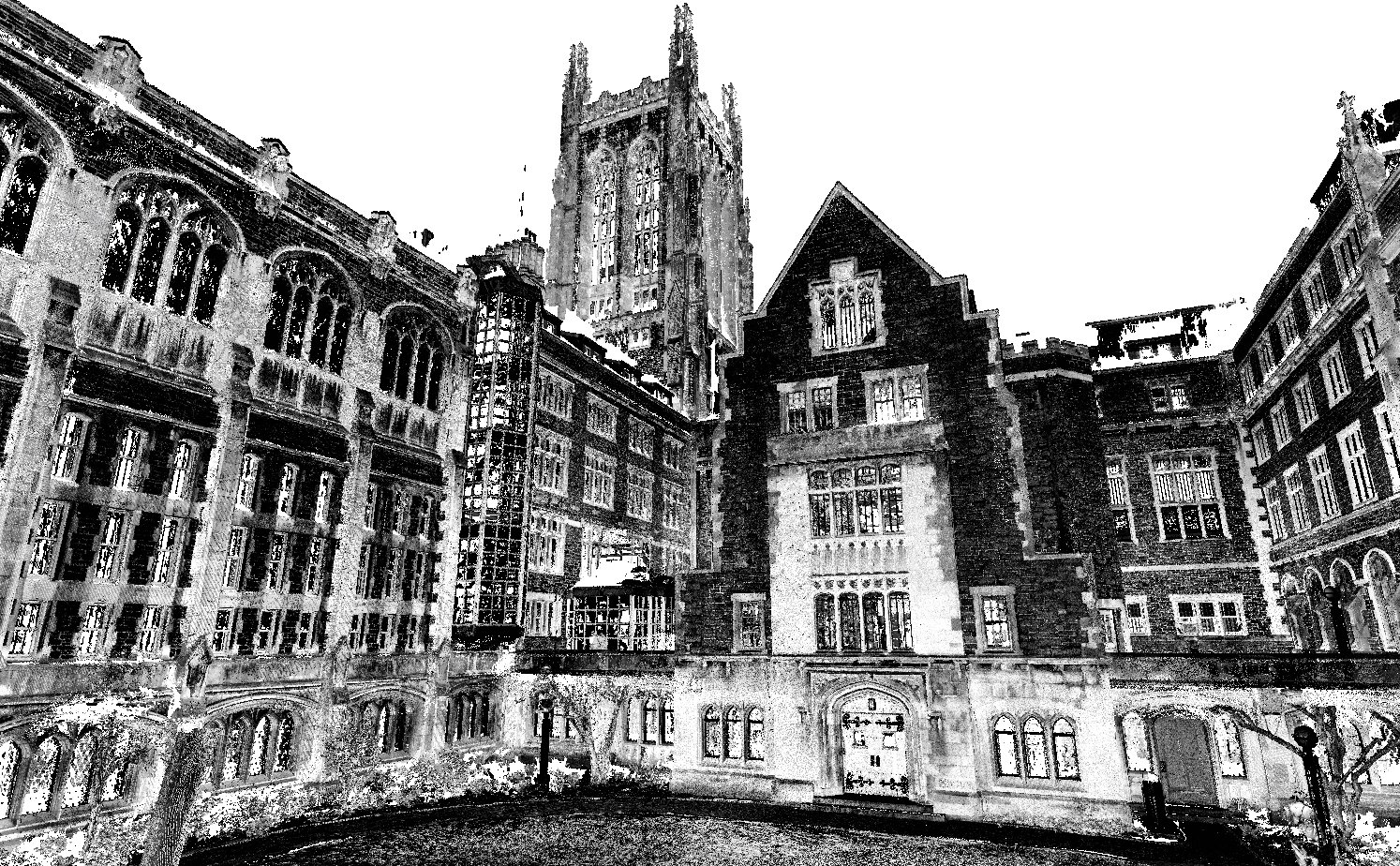
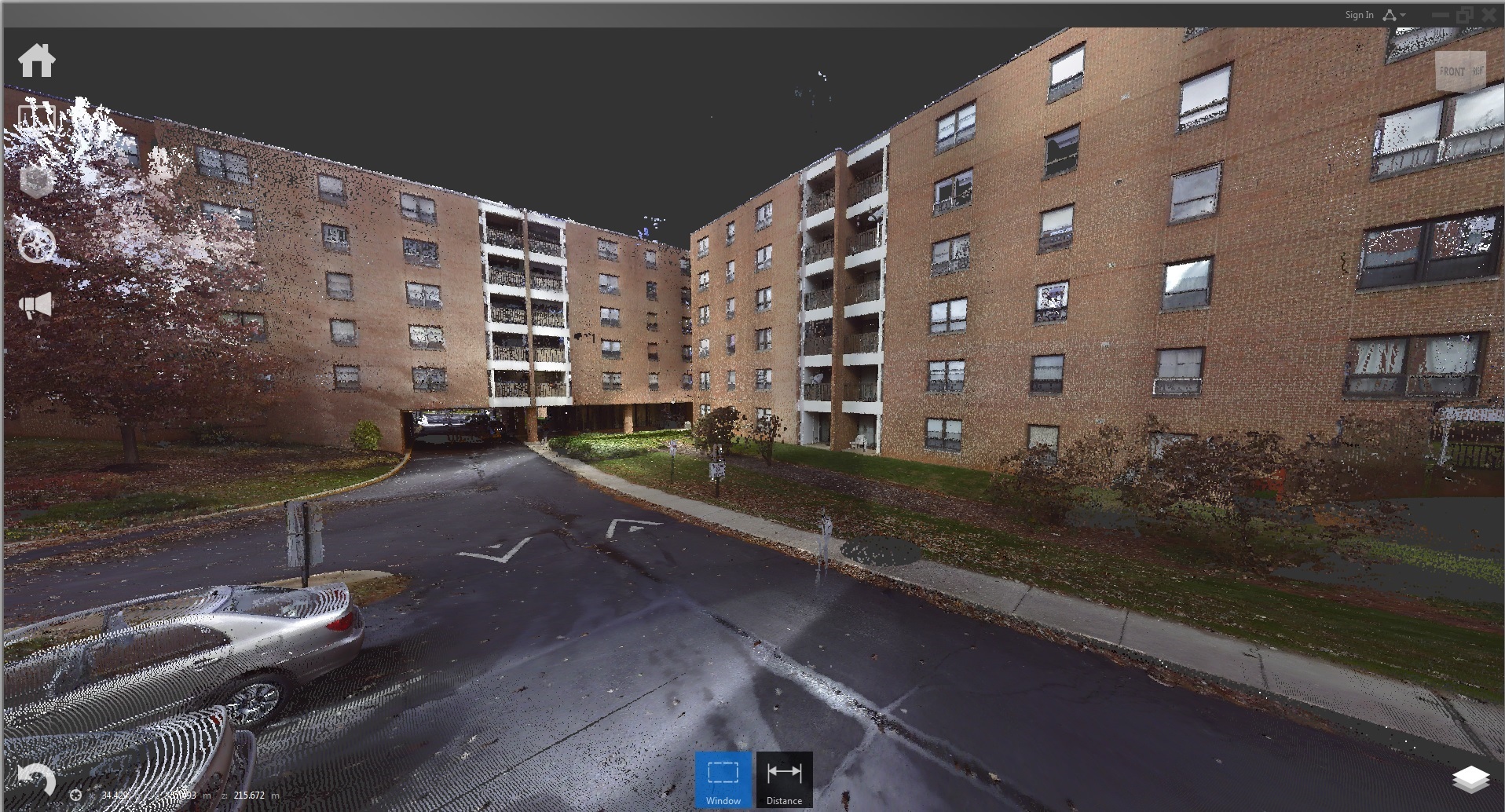
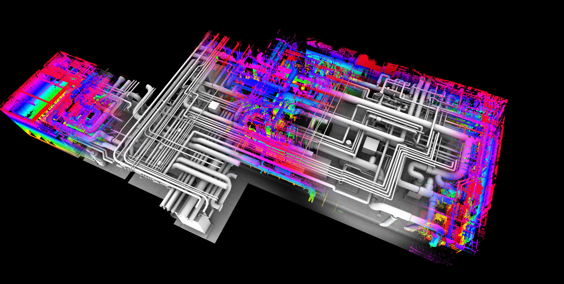
The process of creating digital replications of real-world objects and spaces. Lasers collect information creating a “point cloud” if information, which can then be converted into usable 3D models.
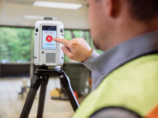
3D Scanner
An imaging device used to collect “point cloud” data, which can then be used to create a digital representation of real-world conditions.
3D Visualization
The process of creating graphics and renderings using 3D software.
Absolute Encoders
An absolute encoder determines “absolute” points in space. No matter how an object is rotated, the data will not be skewed. This allows for multiple scans of an object or location to be taken, from different positions, to be seamlessly stitched together creating an accurate representation of the full space or object being scanned.
Accuracy
Accuracy refers to how close the scanner’s measurement is to the scanned object’s true size.
Airfoil Gauge
A physical gauge used to verify dimensional data on an airfoil shape.
Alignment
The act of collecting data from multiple scans, and arranging them in a way to give a more complete view of the object or space that was scanned.
Animation
Creating movement within a 3D model. This can be done to create walk-throughs of a scanned space.
Annotation Models
A 3d model which contains specific coordinate locations verifying deviations from nominal data.
As Built
An object’s real-world condition.
Augmented Reality
Technology that will superimpose a digital rendering or animation over a user’s view of the real-world
Auto Surfacing
Wrapping multiple NURBS surfaces around 3D scanned data, automatically creating surfaces on your model
BIM
BIM stands for Building Information Modeling. These models integrate multiple disciplines into a digital representation of a build job across its lifecycle.
CAD
CAD stands for Computer Aided Design. CAD software is used by engineers and designers to aid in the design process, and to create 2D and 3D renderings of a project.
Cone Beam
A specialize x-ray beam which produces 2D images of a scanned object. In 3D scanning, these 2D images are then complied together in order to create a 3D model.
Chord Length
A straight-line segment whose endpoints lie on a circular arc.
Cloud Server
A centralized server resource that is hosted over a network that can be accessed on demand by multiple users
Color Map
The result of a Deviation Analysis, highlighting discrepencies between scanned data and existing CAD or 3D data.
Computed Tomography (CT)
Computed Tomography, also known as “CT”, refers to a procedure of computerized x-ray imaging. Multiple images are taken of the same object, which are then combined together in a computer program to create a 3-dimensional, digital image.
Control Point
A specific point amongst a set of points that are used to determine that shape of a surface.
CT Reconstruction
Using computer software to recreate a 3D object using X-ray data taken at multiple angles.
Datums
A piece of information – such as a line, plane, or point – that is used as a reference when processing materials or measurements.
Design Intent
Creating a 3D model of an object that works as intended. This will include fixing any process errors, so the model will not be an exact duplicate of the real-world object.
Decimation
The act of reducing your 3D file size by reducing the number of polygons in the 3D mesh.
Deviation Analysis
The comparison of 3D scan data to existing CAD or scan data. The result of this process is often referred to as a “color map”.
Digital Twin
A virtual object with accurately reflects a real-world object.
“Dumb” Solid
models that do not have design history or definition.
Envelope Modeling
The construction of CAD drawings around 3D scan data to accurately define maximum volumetric parameters.
Exact Surfacing
A spline or NURBS model used to define a 3D point cloud-based mesh. This is one of the most accurate ways of surfacing and will define imperfections captured by the 3D scanner.
Geometric Dimensioning & Tolerancing Inspections
A system of communicating and defining design intent and engineering tolerances. This helps engineers and manufacturers control variations in the manufacturing process.
Handheld Scanner
A portable piece of equipment used to capture real-world information and converts it into point cloud data.
Hybrid Modeling
A modeling technique using both NURBS surfacing and solid modeling.
IGES
IGES stands for Initial Graphics Exchange Specification. This is a file format used in CAD systems.
Intelligent Based Modeling
The defining of a CAD model using dimensional constraints. This allows the model to be adjusted dimensionally while maintaining its integrity.
Laser Scanner
Equipment that uses lasers to capture real-world data and converts it into 3D digital data.
LIDAR
LIDAR is a scanning solution which stands for Light Detection and Ranging. This is used for determining ranges by targeting and object with a laser and measures the time it takes for the reflected light to return back to the receiver.
Long Range Scanning
The ability to scan data miles away.
Measurement Uncertainty
The range of possible values within which the true value lies.
MEP
Stands for Mechanical, Engineering, Plumbing.
Mesh
A mesh is the structure of a 3D model which is created out of connected polygons.
Metrology
The science of measurement.
Microfocus
The capture of high resolution 2D data.
Modeling
In terms of the 3D arts, modeling refers to the process of creating a 3D representation of and object by manipulating polygons along the X, Y, and Z-axes.
NanoCT
Capturing high resolution images using CT. These images are able to be measured in nanometers.
Nano Focus
Concentrating an x-ray beam in way that creates an image that can be measured in nanometers.
Noise
Noise occurs when there is a lower level of precision in the captured point cloud data.
NURBS
NURBS stands for Non-Uniform Rational B-Splines. NURBS are mathematical representations of 3D geometry that can accurately describe any shape from a simple 2D line, to a complex 3D surface.
Ordered Data
This refers to equal point spacing when capturing 3D point clouds.
Parametric Model
Any model that captures all information about its predictions within a finite set of parameters.
Parametric Modeling
A 3D modeling process with the ability to change the model’s geometry as soon as the dimension value is modified. This type of modeling is used to display design intent.
Phase Based Laser
A phase base laser emits waves with different wavelengths. These different wavelengths are then compared to each other and the displacement is =determined via the phase shift.
Phase Based Scanner
A piece of equipment that uses the phase based method to capture 3D images of a real-world object. Phase based scanners offer high measurement speeds, high accuracy, and high resolution images.
Photogrammetry
The use of photography in surveying and mapping to measure distances between objects.
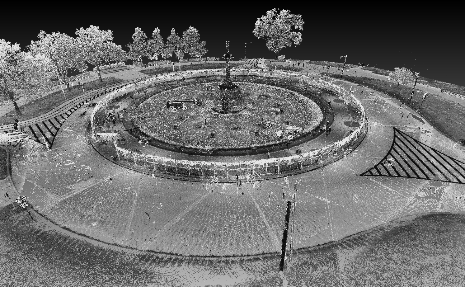
Point Cloud
A set of data points in space. These points may represent a 3D shape or object.
Polygonal Model
An approach to 3D modeling that involves creating surfaces and shapes using polygon meshes.
Precision
Precision is the measurement of the repeatability of a measurement.
Poly-Mesh
A model that uses polygons connected by the edges in order to define the shape of a model.
Prismatic Modeling
The process of modeling 3D objects using simplistic shapes – such as planes, cylinders, and cones – in order to create smoother representations of real-world objects. This can be used to correct imperfections captured by a scanner.
Reality Capture
The process of capturing 3D data to reflect the real world condition of an object or a space.
Raw Point Data
Un-manipulated point cloud data collected by a 3D scanner.
Re-Engineering
The process of refining the design of an existing part or model to optimize the performance of its intended use.
Registration
The process using reference points to align multiple images to create a 3D model.
Rendering
The process of converting 3D digital data into a 2D image.
Repeatability
The variation in measurements taken with the same piece of equipment, under the same conditions, across multiple tests.
Resolution
The level of detail in a 3D model. High-resolution refers to a model with a greater level of detail whereas low resolution refers to a model with a lesser level of detail.
Reverse Engineering
The process of rebuilding an existing part or object.This may be done with the end goal of duplication or enhancement.
Scan
The conversion of real-world, tangible objects into a digital form.
Scan-to-BIM
The process of digitally capturing objects and spaces via 3D scanners, and converting the captured point cloud data into a digital model that can then me used in construction projects.
Schematic
Two-Dimensional, or 2D drawings describe flat renderings that only includes two dimensions (either width and height width and length, or height and length).
Also see “2D Drawing”
Shell
The outer wall of a 3D model.
Spatial Database
A spatial database is a database that is enhanced to store and access spatial data or data that defines a geometric space.
STEP
STEP stands for “Standard for the Exchange of Product Data”. STEP is a file type used in 3D modeling.
STL
STL stands for Standard Tessellation Language. STL is a 3D file format than contains only the surface geometry of a 3D objects.
Scan to CAD
The process of collecting data via a 3D scanner and converting it into CAD format.
Scan to Print
The process of collecting digital data via a 3D scanner and converting it into a printable 3D model.
Sectioning
2D images created through the “slicing” of a 3D object.
Solid Modeling
Creating a 3D model that is theoretically “filled in” and contains mass.
Surface Model
A model that is defined only by visible surfaces. These models are hollow.
Surface Profile
The tolerance zone of a given geometric surface of a model.
Targets
Targets are physical objects that you set up on site that scanning software uses to tie together multiple scans.
Time of Flight
The measurement of how long it takes a wave, particle, or object to travel a certain distance.
Time of Flight Scanners
A 3D scanner that uses emits a laser and measures the time it takes for the laser to reflect back off of the object being measured.
Topographic Model
A model which shows the elevation of an object.
Topography Map
A map which shows the 3D terrain of an object or location. Colors, shading, and contour lines can be used to represent changes in elevation.
Transmission Target
A tungsten covered target that is positioned at the end of an x-ray tube used to ensure high magnifications.
Triangulation Scanner
A scanner which projects a specific grid pattern. The scanner then measures the distortions within the grid in order to determine the shape of the scanned object.
See White Light Scanner
Virtualization
The creation of a digitized environment as opposed to physically building the environment.
Virtual Reality
Computer generated, 3D environment which can then be interacted with in a seemingly real way.
Videogrammetry
The creation of a 3D image by stitching together still frames of a video showing a particular object from different angels.
Volume Measuring
The measure of a 3-dimensional space using cubic units.
Volumetric
Pertaining to the measurement of volume of an object. It is commonly used to describe a type of CAD model that encompasses the maximum shape condition of an object.
Voxel
A single pint within. 3D space.
Walkthrough
The ability to take a virtual tour of a space or object through CAD 3D models.
Watertight
In relation to a 3D model, watertight means that each triangle, or polygon, that makes up the model has exactly two neighbors. Theoretically, this means that there will be no holes or gaps in your model.
White Light Scanning
The process of using a scanner to project a specific grid pattern. The scanner then measures the distortions within the grid to determine the shape of the scanned object.
White Light Scanner
A scanner which projects a specific grid pattern. The scanner then measures the distortions within the grid in order to determine the shape of the scanned object.
See Triangulation Scanner
About BluEdge
BluEdge is a national provider of comprehensive Business Technology Solutions and Experiential Marketing Services. We’ve been supporting our clients since our establishment in 1898. BluEdge has been family-owned and operated for over 125 years and is proud to be a certified Woman Business Enterprise.
BluEdge has six locations in Carlstadt, NJ, New York, NY, Boston, MA, Philadelphia, PA, Washington, D.C., and Chicago, IL.